Please find below the
Finalist Evaluation
Judges'' ratings
| • | Novelty: | |
| • | Feasibility: | |
| • | Impact: | |
| • | Presentation: |
Judges'' comments
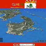
Great job on addressing the transferability of this project, and clarifying the point that this is a process as much as a product, and that stakeholder involvement is the key. This is a great tool for identifying vulnerability risk. The proposal would be stronger if it more explicitly addressed the question of resilience and what communities can do to decrease their vulnerability; identifying problems needs to be the beginning of the process, not the endpoint. This project does a good job of visualizing the risk to coasts, but it was less clear how this project would also help to provide information on resilience and steps communities can take to improve resilience. We were also hoping to see more detail about how the VGI would be implemented, as that was not entirely clear. And we wondered about the value of 3D visualizing capacity; might it be less expensive and just as effective to use 2D? 3D imaging can in many cases be distracting to users more familiar with traditional maps.
Also, NOAA stands for National Oceanic and Atmospheric Administration, not Oceanographic.
Semi-Finalist Evaluation
Judges'' ratings
| • | Novelty: | |
| • | Feasibility: | |
| • | Impact: | |
| • | Presentation: |
Judges'' comments
We liked this proposal very much; it’s novel, interesting, and exciting. We really like the idea of including personal narratives and information to tell a more effective story about coastal erosion and inundation. Our primary concern here is that in the current incarnation CLIVE is very location-specific. It’s a great tool for PEI, but is it transferable? What would be required (financial and other resources) to apply the methods you have used to other regions and communities?
No comments have been posted.
