 Climate Colab Aug 6, 2014 12:34 |
We liked this proposal very much; it’s novel, interesting, and exciting. We really like the idea of including personal narratives and information to tell a more effective story about coastal erosion and inundation. Our primary concern here is that in the current incarnation CLIVE is very location-specific. It’s a great tool for PEI, but is it transferable? What would be required (financial and other resources) to apply the methods you have used to other regions and communities?
|
 Mark Capron Aug 9, 2014 10:02 |
This proposal may be the best for informing people because it offers the most efficient and accurate way to predict and explain future flood/property insurance costs.
You might have noticed how educated everyone became when the U.S. Congress removed the subsidies on Flood insurance because the expense of Katrina and Sandy proved rates were too low.
With CLIVE, insurance companies can predict their rates for each property parcel a decade or so in advance. People won't be buying houses without checking the future rates. Lenders won't be lending without checking the future rates.
People are inspired to learn a subject when it threatens to vacuum clean their personal wallet.
|
 Kerstin Mueller Aug 21, 2014 07:22 |
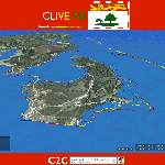
I love the interactivity that comes with CLIVE and the easy and intuitive applications. Actually seeing in 3D the effects of sea level changes in one's familiar surroundings is a great tool to raise awareness of the risk, and motivate and empower the coastal communities to make informed decisions about how to deal with it.
In addition to the very useful applications that are described in the proposal, such as focusing on existing key infrastructure points like the water treatment plant in the example, CLIVE would be a great tool for investment planning. For example, some agricultural crops need several years of growth and care before they can be harvested for the first time - nobody would want their investment flooded or affected by increased salinity, and CLIVE could be used to select safe locations among different areas considered for planting. The same goes for new buildings.
|
 Victor Blanco Aug 26, 2014 03:25 |
I wish you the best! Please, check my proposal in Waste Management Contest, named "REACC: Recycled Debris for Adaptation to Climate Change"; and I would apreciate your support as I supported your proposal.
|
 Climate Colab Sep 3, 2014 12:20 |
Great job on addressing the transferability of this project, and clarifying the point that this is a process as much as a product, and that stakeholder involvement is the key. This is a great tool for identifying vulnerability risk. The proposal would be stronger if it more explicitly addressed the question of resilience and what communities can do to decrease their vulnerability; identifying problems needs to be the beginning of the process, not the endpoint. This project does a good job of visualizing the risk to coasts, but it was less clear how this project would also help to provide information on resilience and steps communities can take to improve resilience. We were also hoping to see more detail about how the VGI would be implemented, as that was not entirely clear. And we wondered about the value of 3D visualizing capacity; might it be less expensive and just as effective to use 2D? 3D imaging can in many cases be distracting to users more familiar with traditional maps.
Also, NOAA stands for National Oceanic and Atmospheric Administration, not Oceanographic.
|
 Victor Blanco Oct 4, 2014 11:56 |
Congratulations!!!
Please check the "Discusion Section" in the "Community" label... Proposal of activity during the Conference Session of 2014 Winners...
https://www.climatecolab.org/web/guest/discussion#discussion%3DpageType%3ATHREAD%2CthreadId%3A1337218
|
